ArcGIS vs. Webix UI

Overview
ProductRatingMost Used ByProduct SummaryStarting Price
ArcGIS
Score 8.9 out of 10
N/A
Esri in Redlands, California offers ArcGIS, a geographic information system.
$100
per year
Webix UI
Score 8.7 out of 10
N/A
Webix is a multi-widget JavaScript UI library for developing HTML5 and CSS3 compatible mobile and desktop web apps. It provides over 90 feature rich UI widgets for data management, visualization, uploading, building layouts and editing. The components enable users to build web apps that will run properly not only on personal computers but also on iOS, Android and Windows touch devices. Webix offers simple JQuery, Angular and Vue.js integration and can work with any server-side platform,…
$848
Pricing
ArcGISWebix UI
Editions & Modules
Viewer
$100
per year
ArcGIS for Personal Use
$100
per year
ArcGIS for Student Use
$100
per year
Editor
$200
per year
Field Worker
$350
per year
Creator
$500
per year
GIS Professional Basic
$700
per year
GIS Professional Basic
2,750
per year
GIS Professional Advanced
3,800
per year
Custom License
$848
Company Pack
$2499.00
one project, unlimited developers
DevTeam Pack
$3999.00
unlimited projects, 5+ developers
Unlim Pack
$9499.00
unlimited projects unlimited developers
Offerings
Pricing Offerings
ArcGISWebix UI
Free Trial
NoYes
Free/Freemium Version
NoYes
Premium Consulting/Integration Services
NoNo
Entry-level Setup FeeNo setup feeNo setup fee
Additional Details
More Pricing Information
Community Pulse
ArcGISWebix UI
Considered Both Products
ArcGIS
Chose ArcGIS
N/A, I have not used any other tools like ArcGIS. While I know Tableau does a lot of the same things, I cannot compare the two.
Chose ArcGIS
We would export circuit models used in Windmil to an Autocad drawing to print paper maps. This is nothing in comparison to what ArcGis is capable of.
Chose ArcGIS
My students love the "drop" feature in Google Maps, but besides that it truly doesn't compare. I love that you can add, delete, or change layers to this map to better understand its larger affect. There are many more ways to manipulate maps on ArcGIS than on Google Maps. I can …
Chose ArcGIS
To be honest, there isn't really any competition to ArcGIS, while there are smaller applications such as QGIS, they are not enterprise. Meaning that they might do onething well, but not at a enterprise level. Other applications such as google maps api, and mapbox, is just …
Chose ArcGIS
I was working with this software fore more than 10 years. I learned ArcGIS at University and I believed this software to be essential in the management of GIS. It was before I tried QGIS. I regret my purchase by the expensive cost, the complex method to licencing and the weak …
Chose ArcGIS
These alternatives to ArcGIS have one thing in common - they are all generally more user-friendly, and they all lack the capability of ArcGIS. ArcGIS can do most anything geographically-related, while these other products do one or two things very well. For instance, ArcGIS's …
Chose ArcGIS
ArcGIS is the only tool we have the geocodes addressed on premises without sending data over the internet. We could have explored that option with Spotfire but it was out of our price range. I also tried to do this manually using PostgreSQL which also has a free implementation …
Chose ArcGIS
Much better than any other similar product in the market.
Chose ArcGIS
None of the competing products we use are listed - we use Hexagon Digital Cartography Studio, ENVI, and MapServer. These products fill gaps or are open source alternatives sought by clients.
Chose ArcGIS
I am more familiar with ArcGIS and therefore, in some ways, I find it more intuitive to use than Spotfire. ArcGIS is more of a fundamental GIS system where as Spotfire incorporates additional tools like data graphing. ArcGIS was best for our research projects because we were …
Chose ArcGIS
ArcGIS is way more useful, especially in terms of bringing in non-ACS data. However, if we are in a rush, sometimes our firm will just make Social Explorer maps to easily get the point across. It's not really a comparison, though, and ESRI definitely has the field on lock …
Chose ArcGIS
ESRI is really the only serious GIS software we have used in the last 27 years. AutoCAD did/does have some GIS capabilities. Less expensive versions of ACAD were available that could have in the past been used to do GIS on the cheap. Other than ACAD, we have seen other …
Chose ArcGIS
I have used other free use GIS programs and even some online apps but none can compare to the amount of functionality as ArcGIS. ArcGIS has all the features and ease of use to manage and look at data that most programs lack.
Chose ArcGIS
More powerful tool which has much more functionality
Chose ArcGIS
There is a reason why ArcGIS and Esri is still a leader in the spatial data industry. Their tools are irreplaceable, though many other mapping companies are taking the technology further and enabling their maps to be better seen or used on a web-based platform or browser. …
Chose ArcGIS
ArcGIS and QGIS have a lot of similarities between their products. Where ArcGIS stands out is with their online version of their software. ArcGIS's online solution will pair up with your on-prem solution to offer a fully synchronized system. I wasn't able to duplicate the …
Chose ArcGIS
ArcGIS does not have some of the geologic data mapping capabilities and tuning capabilities of Geographix, but in almost every other way, from map quality, manipulation of map properties, speed, and ease of use, I find ArcGIS far superior.
Chose ArcGIS
I find ArcGIS to be more consistent and reliable.
Chose ArcGIS
In my opinion ArcGIS is the most comprehensive geographic information system program in the world, select it over QGIS because it contains all the tools for a proper planning of the territory. arcgis offers the best geo-statistics tools, automated cartography, maps …
Chose ArcGIS
ArcGIS is overall a better program than most of the competitors. It is generally more user-friendly, has better displays, and more customization than other programs. It is especially useful in the geosciences and workplace settings, where data can be seamlessly shared among …
Chose ArcGIS
I have used the GVSIG software, but I decided to stay with ArcGIS because it seems more complete and functional. With ArcGIS I have many more analysis tools, such as Arc toolbox. The management of statistics within the software seems great, as well as the possibility of …
Chose ArcGIS
Select ArcGIS because it is a work tool for professional recognition of experts linked to the geography and planning of the territory.
It is a very complete program because it allows you to debug content, georeference, analyze content, and cartography design. It is the best …
Chose ArcGIS
ArcGIS is more robust than QGIS, but often slower and more memory intensive. QGIS is also free, while providing at least 90% of the functionality. Although it might be difficult to get used to the interface differences between the two programs, QGIS is a worthy competitor …
Webix UI
Chose Webix UI
It seems very convenient to us. It has a large component library and rich UI. The navigation is great. The documentation is very good as well. The Kanban board is fantastic and flexible.
Chose Webix UI
React was too time consuming. Kendo was another good one, but more expensive and seemed less responsive. [Sencha's] demo didn't seem to justify the price.
Best Alternatives
ArcGISWebix UI
Small Businesses
Google Maps API
Google Maps API
Score 8.3 out of 10
Syncfusion® Essential Studio®
Score 6.1 out of 10
Medium-sized Companies
Google Maps API
Google Maps API
Score 8.3 out of 10
React
React
Score 9.3 out of 10
Enterprises
Google Maps API
Google Maps API
Score 8.3 out of 10
React
React
Score 9.3 out of 10
All AlternativesView all alternativesView all alternatives
User Ratings
ArcGISWebix UI
Likelihood to Recommend
7.5
(0 ratings)
9.0
(0 ratings)
Likelihood to Renew
8.0
(0 ratings)
-
(0 ratings)
Usability
10.0
(0 ratings)
-
(0 ratings)
Support Rating
9.1
(0 ratings)
8.0
(0 ratings)
User Testimonials
ArcGISWebix UI
Likelihood to Recommend
I'm very grateful to be able to use it, and I have a master's degree with a focus in Geospatial Analysis. There can be a bit of a learning curve, and I try to build user-friendly ways for volunteers to see & collect data. Meanwhile, if a colleague is less confident with building such a system, it may be more difficult for them to implement.
Read full review
Webix makes it easy to build a complex Web UI. Combining technologies (like React and Webix) is tricky. Most features work as expected but some are tricky. In way React Components "communicate" and the way a complete Webix Form works is not exactly compatible. Some of these problems are not obvious. However with a good design it is easy to fix. React has to orchestrate the page and each Webix Component / Form is independent from the others and relies only on Rect to integrate. Using Webix alone (iE with the JEt Framework) is trivial but was not enough for our whole application.
Read full review
Pros
  • ArcGIS Online simplifies complicated functions in ArcMap.
  • Allows you to layer various data points on top of each other
  • Enables for some spreadsheet calculations within the platform (instead of having to do every single step in Excel before bringing it in as a CSV.)
Read full review
  • Customizable widgets and controls help you to present different types of data nicely and work with it.
  • Most of the popular data formats are supported. Large component library and rich UI.
Read full review
Cons
  • There is a steep learning curve for ArcGIS users.
  • It takes a lot of computing power for ArcGIS, as it can't be installed on every computer.
  • At times, tools can be outdated and there are many similar competitors making more web-based tools that can replace ArcGIS.
Read full review
  • Since we are using react as foundation it was difficult to use some features in our environment. In the beginning we tried to have a drag and drop customizable Webix UI combined with React and failed miserably doing so. Current Version has a much better React integration.
Read full review
Likelihood to Renew
Simply because the program deserves it. It seems to me that it is a fundamental tool for the storage, analysis, and interpretation of medium and large-scale phenomena, unmanageable with traditional engineering software. Its versatility in the handling of the different "layers" with which the data is handled and interpolation tools, make this software a powerful ally both for companies and for the educational part of the universities.
Read full review
No answers on this topic
Usability
Once set up, the tools are extremely easy to use. I had a staff member develop a tool for field data collection, that included an external and internal dashboards to monitor progress in days. The field workers that collected the data, barely knew how to use a computer, and within minutes they could use the application that was configured for them.
Read full review
No answers on this topic
Support Rating
ArcGIS' web support is quite good. They also have a broad user base that is active in answering community members' questions. For more sophisticated questions, ArcGIS technical support is good at answering questions, although answers usually are not instantaneously available. I'd also say that ArcGIS is working hard at making its technical support more reachable, at least it appears that way.
Read full review
Webix UI is a cross-browser, cross-device JavaScript framework which makes it easy to build a complex Web UI. Most features work as expected. While working with large datasets, you can load data dynamically to reduce complexity and improve performance. It provides a set of integration extensions that allow you to add third-party tools into an application.
Read full review
Alternatives Considered
My students love the "drop" feature in Google Maps, but besides that it truly doesn't compare. I love that you can add, delete, or change layers to this map to better understand its larger affect. There are many more ways to manipulate maps on ArcGIS than on Google Maps. I can also add personal details and information if I want to create a specific map, something that I am unable to do with Google
Read full review
It seems very convenient to us. It has a large component library and rich UI. The navigation is great. The documentation is very good as well. The Kanban board is fantastic and flexible.
Read full review
Return on Investment
  • The high availability of training exercises and materials available save valuable faculty time - we don't have to create those materials from scratch.
  • The ability to use the software for a wide variety of application spaces gives us maximum flexibility in pursuing extramural funding
  • Novel applications developed by our team help facilitate university success
Read full review
  • Fast development time has allowed us to move quickly
Read full review
ScreenShots

Webix UI Screenshots

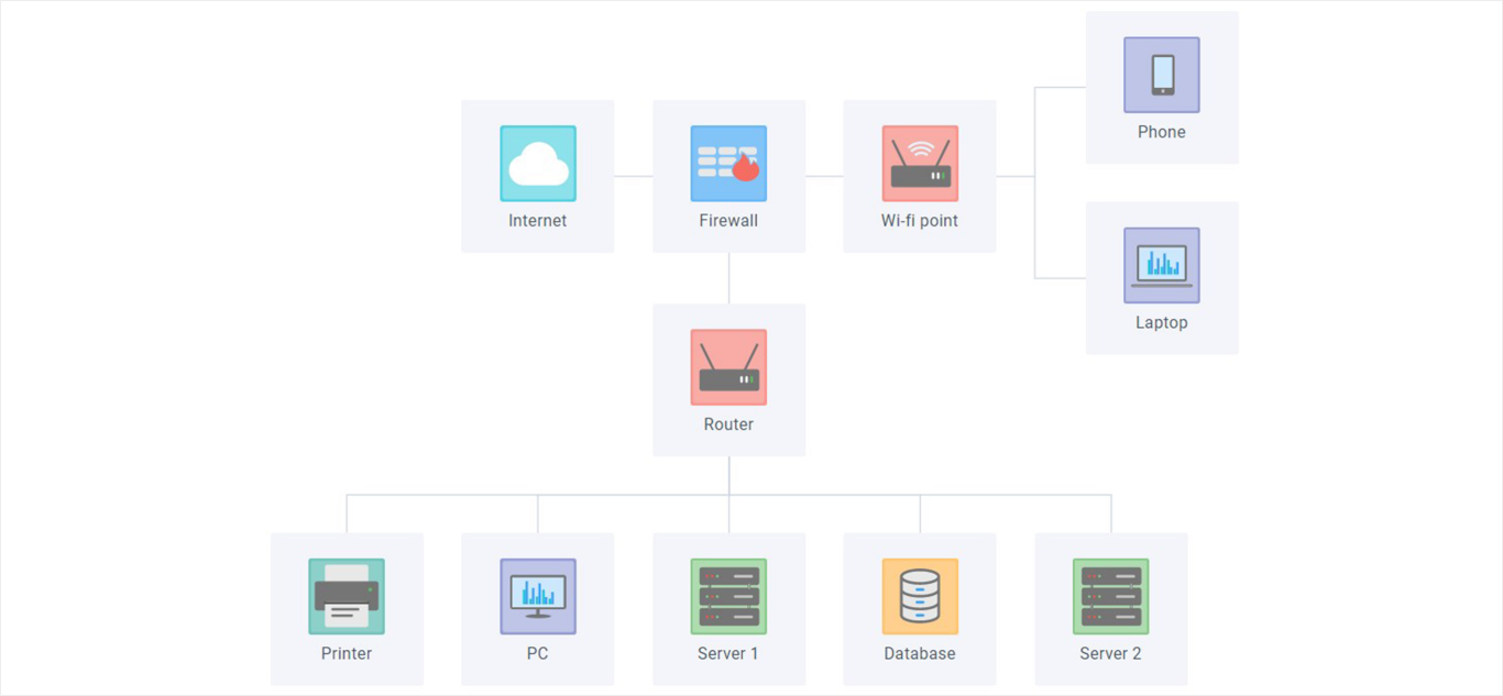
Screenshot of Chat / Messenger - JavaScript widget for web communicationScreenshot of Javascript Diagram LibraryScreenshot of JavaScript Document Manager widget for web developmentScreenshot of JavaScript File Manager, HTML5 UI web widgetScreenshot of Gantt Chart: JavaScript online project management applicationScreenshot of Kanban JavaScript UI widget or Tasks Management Board